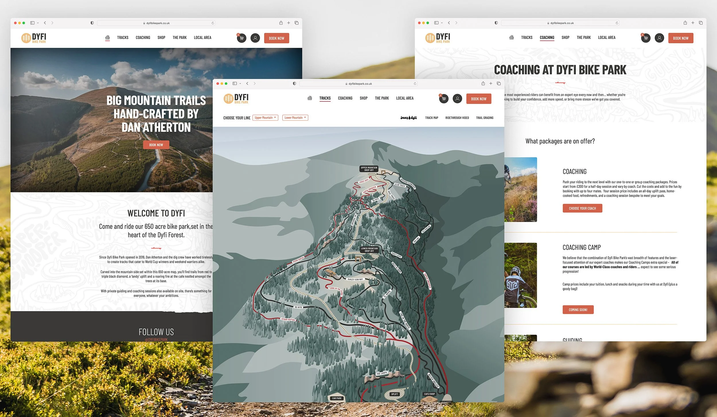
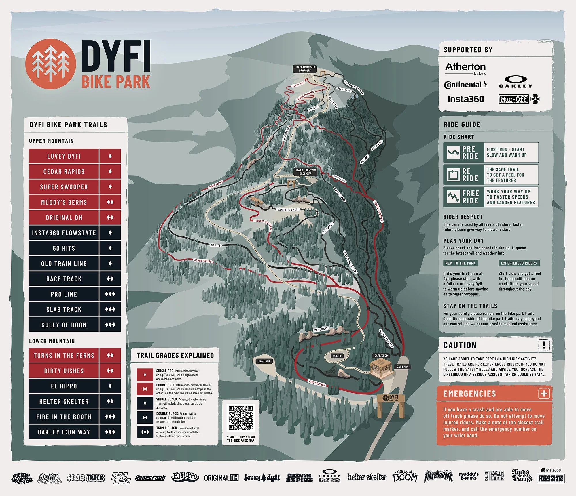
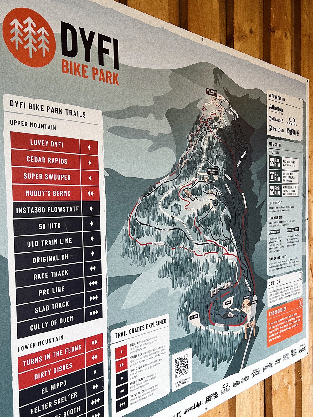
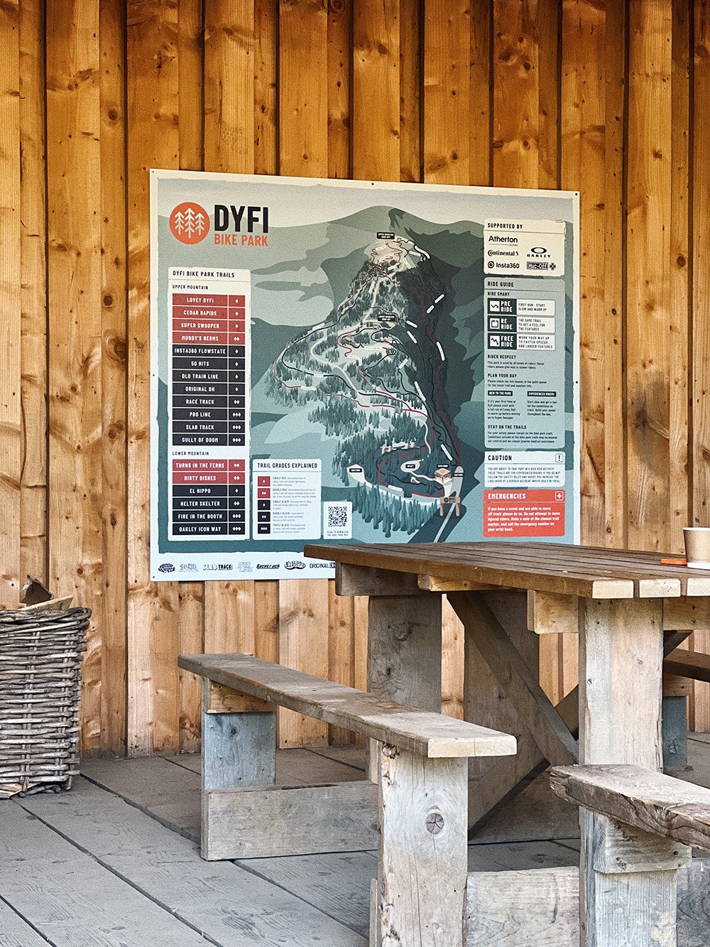
Dyfi Bike Park - Trail Map
Set in the heart of Dyfi Forest on the edge of Snowdonia, the 650 acre bike park features red and black grade trails hand-crafted by Dan Atherton and his dig crew. First opened in 2019 with four black trails, the bike park has expanded and evolved to become the world-class destination for intermediate and elite riders.
As a long-term collaborator and a regular rider at the Bike Park, I was brought in to create a new trail map to illustrate the complex network of Dyfi Bike Park trails.
Design Process
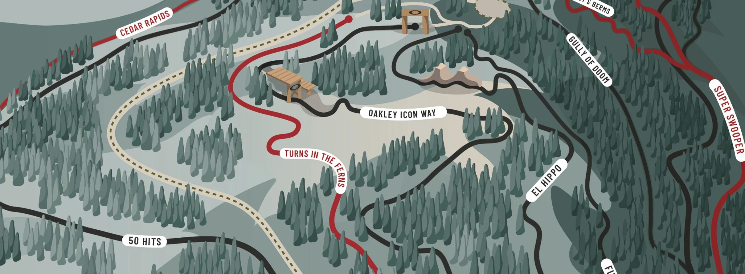
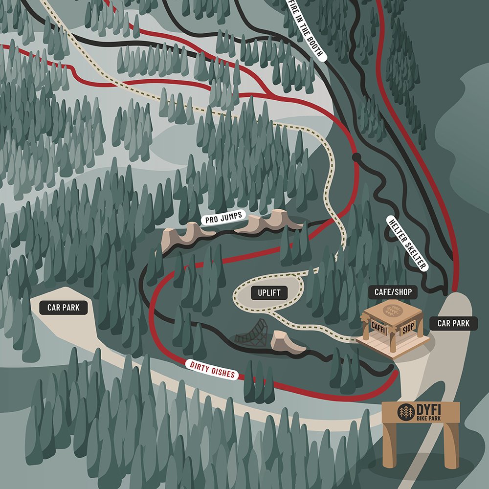
The map took us some time to develop as the bike park was constantly changing, tripling the number of tracks in just three years. We figured out that the best way to showcase such a complex layout of tracks would be in aerial view using a 3D effect. To create the first sketch, I combined GPS tracking with Dan’s markups of aerial maps, to make sure the trail map is as accurate as possible.
While we looked at ski maps for inspiration, my goal was to design a bespoke map by building all of its elements from scratch. I used colour gradients and scale to create a sense of depth, applying the new brand style I developed for the bike park over the past three years.

The map has been made interactive on the website, allowing riders to click on specific tracks and learn more about each trail before visiting the bike park.